
PRESS RELEASE: High-tech Lasers to Map Market Street for Comprehensive 3-D Survey - 11/14/15
San Francisco — San Francisco Public Works and the San Francisco Municipal Transportation Agency (SFMTA) will use a high-tech mapping system to conduct the most complete survey yet of Market Street’s building facades, light poles, BART station portals, sidewalks, fire hydrants and other street features and utilities.
The visual mapping survey is the first step toward doing detailed design work for the Better Market Street project, allowing the team to move from conceptual to detailed designs and then on to construction to improve San Francisco’s premier corridor.
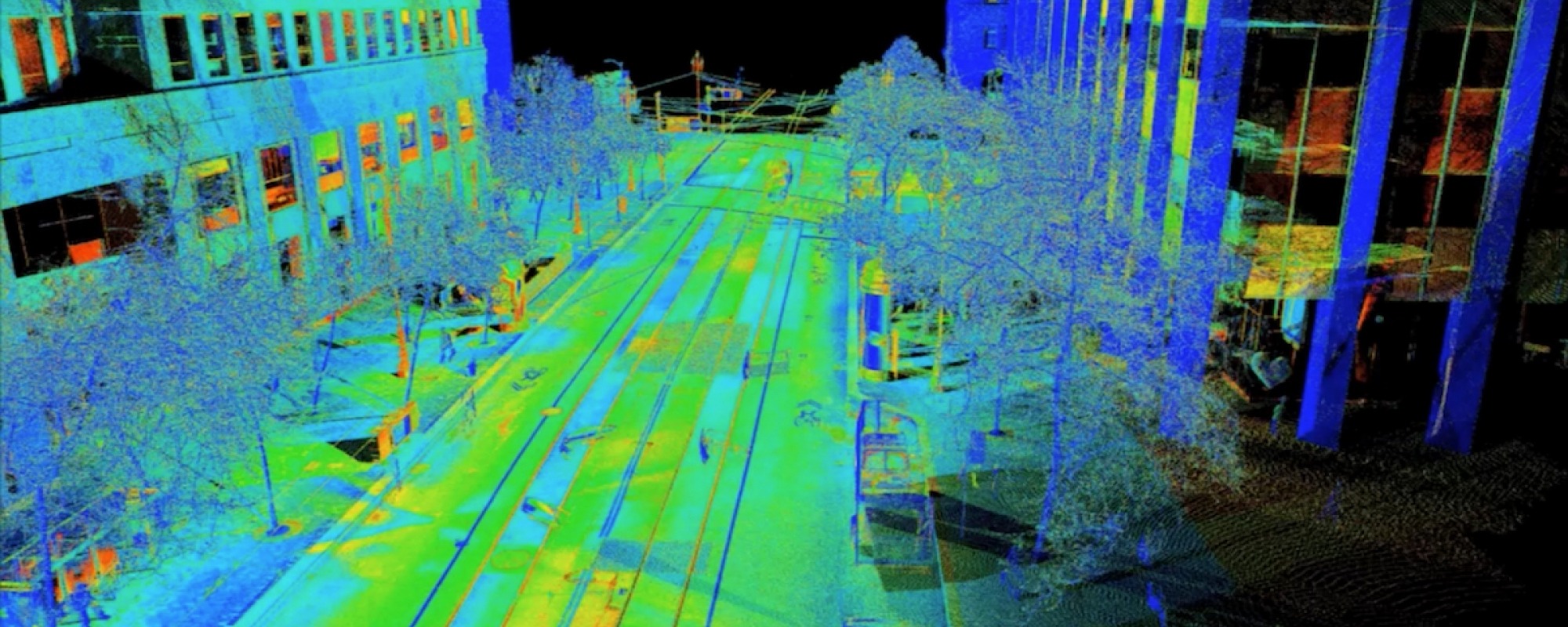
A truck, mounted with Light Detection and Ranging (LiDAR) equipment, will run along Market Street between Octavia Boulevard and Steuart Street -- four times over the course of one night -- to get a comprehensive picture of Market Street’s fixed assets and elevations. For more information regarding LiDAR, please see this link.
Weather permitting, the survey will occur in the pre-dawn hours on Sunday, Nov. 15, 2015, between 3 a.m. and 5 a.m. -- a timeframe when the LiDAR equipment can get accurate measurements of building distances and street furniture while having the least amount of vehicles and people on the street.
The project will impact parking and traffic in the area. Private cars, taxis, commercial vehicles and bicyclists are encouraged to use adjacent parallel streets, such as Mission Street, during these pre-dawn hours.
Parking, loading and unloading between the hours of 1 a.m. – 6 a.m. on Nov. 15 on Market Street and within one block of Market Street between Octavia Boulevard and Steuart Street will be prohibited to ensure the street is clear for the survey.
A police motorcade will escort the LiDAR truck, which shouldn’t stop anywhere along its route in order to protect the integrity and precision of the scan. The truck, at times, will travel against the flow of traffic. The center lanes on Market Street will remain open to vehicular traffic. Cross street traffic, meanwhile, will be impacted, as police temporarily block off the intersections to let the LiDAR truck move along Market Street unimpeded.
To make the police and survey truck motorcade more visible, signalized intersections on Market Street between Octavia Boulevard and Steuart Street will be set to flashing red to bring motorists to a complete stop at the intersections and slow traffic.
Temporary tow-away signs have been posted along Market Street and all the cross streets so that motorists don’t park and block the LiDAR truck from getting accurate measurements. The SFMTA enforcement division will assist the police by towing and citing vehicles that have parked in the temporary tow-away areas.
For more information regarding the Better Market Street project, please visit the website.
###
Mission
San Francisco Public Works is one of the largest and most complex municipal operations in the City, with a 1,600-member workforce and a $384 million annual operating budget. The department's active capital project portfolio exceeds $3 billion. As one of San Francisco oldest City departments, it is also one of the most forward-thinking. Keeping San Francisco beautiful, safe and sustainable.
Additional Resources

![]()
Follow us: 


